(Planning and Design Section)
A Commentary by
Gloria Markines Reyes
Help! This is the cry of nature lovers and people who have the foresight to leave a sustainable earth that future generations can be proud of.
The destruction of the coastlines of Maasin City is becoming a reality, as the development planners and government implementers believe that this is the way to “progress.”
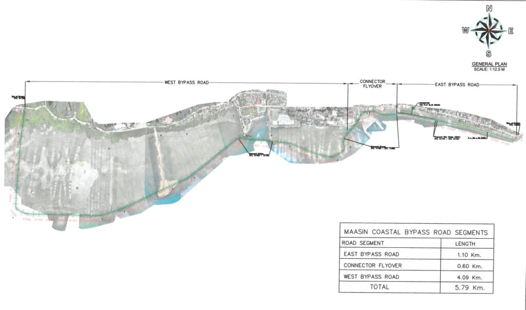
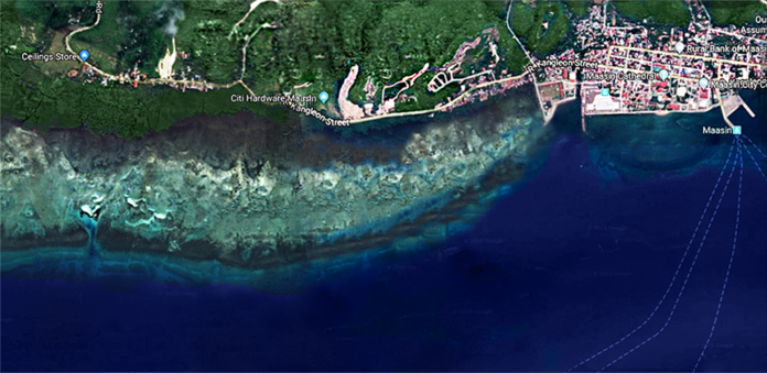
The P1.5 billion Maasin City Coastal Bypass Road involves “the construction of 4.71 kilometerby-pass road to traverse a non-existing alignment with shoulders inside walks traversing the off-shore location of Maasin City.” The road will connect Lib-og village to barangay Mambajao. Data from the Department of Public Works and Highways (DPWH) indicate that the project will require 800,000 square meters or 80 hectares of open reclamation area in the coast of Maasin City. As illustrated in the front page photo there are three parts in the general plan: west by-pass road, connector flyover, and east by-pass road. The reclamation area is between the off-shore coastal road and the coastline with reefs, mangroves and the Espina Boulevard white beach, which would be covered with filling materials.
The Maasin City reef plays an important part of the Coral Triangle. The Coral Triangle includes the waters of Indonesia, the Philippines, Malaysia, Papua New Guinea, Timor Leste and Solomon Islands. It is important to note that the Philippines contributes significantly in maintaining marine biodiversity balance on earth, while the reefs provide economic benefits to the people.
“Maasin City is fortunate to have the hunasan Reef, to take part in contributing to the marine biodiversity balance. Also in the Maasin City proper coastline is a beach frequented by people from all walks of life and of varying ages. Southern Leyte Times once dubbed it as the “happiest small beach in the world,” where people appreciate the simple joys of nature. Local people and foreigners are awed and amazed at the hunasan, especially with the view of people extracting some seafood produce like edible shells, seaweeds, crustaceans, sea urchins “suwaki” and other delicious finds. Our people treasure this reef. It’s part of Maasin’s culture that should not be obliterated. This hunasan Reef is a work of nature, and part of our precious culture nurtured through generations, that cannot be paralleled by development.” (SLT Issue999)
Furthermore, the coastline of Maasin City craddles the vast coral reefs, mangroves, seaweeds and seagrass which form part of the world renowned Danajon Bank. The city with its 25-kilome¬ter shoreline is part of the Danajon Bank, which is a valuable portion of the Philippine Coral Reef Area, considered as the second largest in South East Asia.
The Maasin City Reef is a biotic reef of the fringing reef type defined by coral.org/wikipedia as a ridge or shoal of rock, coral or similar relatively stable material, lying beneath the surface of a natural body of water. These reefs protect coastal areas by reducing the power of waves hitting the coast – from storms and erosion – provide income for local communities, and offer opportunities for recreation. They are also a source of food and new medicines.
Among the threats are physical damage or destruction from coastal development, dredging, quarrying, destructive fishing practices and gear, boat anchors and groundings, and recreational misuse.(epa.gov)
There must be a creative way to balance progress and preserving the environment. If our government is spending a lot of the people’s money for development, it can at the same time ensure earth’s conservation by not destroying it.


